- YourGovernment
-
OurCommunity
-
- About Tualatin Advisory Committees Animal Services Community Involvement City Codes City Council City Projects
- Community Crime Reports Customer Service Request Explore Tualatin Now Fire Library Municipal Court Tualatin Today
- Parks & Recreation Passports Permits & Forms Planning & Zoning Police Volunteer Tualatin Moving Forward
-
-
ForVisitors
-
- Parks, Greenways, Recreation and Library Library Parks Public Art Parks and Recreation
- Shopping, Dining, and Entertainment Chamber of Commerce
- Community Events Community Theatre Pumpkin Regatta Special Events
-
- DoingBusiness
-
HowDo I?
-
- Apply for a Job Apply for an Advisory Committee Contact the City Council Get a Copy of a Police Report File a Records Request Find Forms
- Find Planning & Zoning Find Public Transportation Find the City Code Get a Business License Get Email Subscriptions/Notifications Locate City Offices
- Contact the City Pay My Traffic Fine Pay My Water Bill Reserve a Facility Sign Up for a Recreation Program Search the Website Volunteer
-
Tonquin Trail Master Plan
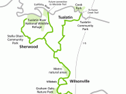
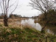
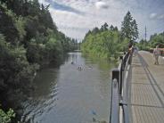
Imagine enjoying a bike and walking trail that begins at the Tualatin River in Tualatin Community Park, continues along beautiful and scenic Hedges Creek and south through the Tonquin Geologic Area to Grahams Oak Nature Park in Wilsonville and through to the Willamette River. Alternatively, trail users could walk or ride west to Sherwood, enjoy the new Cedar Creek Trail and ultimately get to the Tualatin River National Wildlife Refuge.
The Tonquin Trail Master Plan is currently underway and seeks to provide the framework for building just such a trail. In addition to being a highly valued recreation facility, it will also provide commuters, shoppers, students, and service-seekers a nice transportation option as the trail, either directly or through spur paths, will connect neighborhoods, schools, commercial and employment areas, as well as town centers.
The Tonquin Trail Feasibility Study was completed in 2005 and the Tonquin Trail Master Plan process began in July of 2009. The final Master Plan is expected to be completed in the summer of 2012. There has been extensive outreach over the past couple of years to engage Tualatin residents, business and land owners, and other stakeholders in the Master Plan process. There will also be upcoming opportunities for you provide input on the Master Plan. These will be announced on the City of Tualatin website and the City’s monthly newsletter Tualatin Today. If you have any questions about the project or would like to comment on the project please contact Paul Hennon, Community Services Director at phennon@ci.tualatin.or.us.
The Tonquin Trail Master Plan is a collaborative effort between the cities of Tualatin, Wilsonville, and Sherwood along with Metro, Washington County and Clackamas County. Visit the official project website.
Click any thumbnail image to view a slideshow


